Road with a view: The Dempster Highway
- Karin Schreiber

- Apr 26, 2023
- 4 min read
Adventure is calling!

The Dempster Highway is the most fun you can have while sitting down. North America’s most adventurous road trip transports visitors in more ways than one. We will see jagged peaks, crowds of caribou, the Arctic Circle, tight-knit Indigenous communities and the supersized Mackenzie River. And we feel a sense of adventure like no other. Driving the Dempster Highway really is one heck of a ride.
It’s one of the most beautiful panoramic roads in the world. The name alone evokes wanderlust... Formerly the path of the Gwich'in, later used as a dog sled trail, the Dempster begins about 40 kilometers outside of Dawson City in the Yukon Territory. It loops as an all-weather gravel road for more than 730 km through the mountains to far beyond the Arctic Circle towards the Arctic Ocean - more precisely to Inuvik in the Northwest Territories. Adventure is calling!
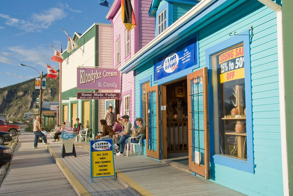
When we picked up our truck camper in Whitehorse, we were strongly advised to fill up our supplies before departure. Especially gas! Up here, in Canada’s far North, gas stations are sparse and it’s highly recommended to take every opportunity to fill up. All right, we got it! We feel like we can feed an entire army as we leave the small supermarket in Dawson City. We certainly won’t die of hunger during our trip on the Dempster Highway!
Now we're finally on our way...
Shortly after the Dempster Highway begins, fang-like peaks rear up, piercing the bright blue horizon. This is epic Tombstone Territorial Park, full of mind-bending mountains, alpine wildlife, tantalizing hiking trails and fine sites for scenic camping.
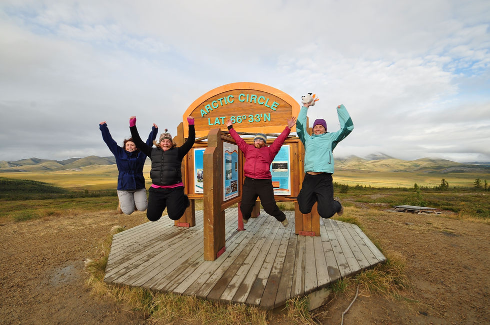
The scenery is breathtaking and our camera is running at full speed. We enjoy the wonderful view and drive, with one or the other photo stop, until the evening. Halfway to Inuvik, we arrive in Eagle Plains, a small town with a campground, hotel and ... a gas station! We stay overnight and spend a lovely evening at Eagle Plain’s only restaurant. As we continue our journey in the following morning, it doesn't take long until we arrive at the Arctic Circle. Welcome to the land of the midnight sun! From here on north, the summer sun never sets, spinning itself dizzy in the sky. Here, adventurers cross into the true polar zone, a mythic region only a fraction of the travellers on Earth have ever entered.
Here, the summer sun shines 24/7 on 57 days, providing plenty of time for all kind of outdoor activities. The brilliance of light is simply phenomenal! Again, our camera clicks without stopping.
The Dempster now crosses the border to the Northwest Territories – we set our watch one hour ahead. The route leads far above the tree line through the spectacular Richardson Mountains.
Again and again we see wildlife directly from the road – Dall sheep, caribou and black bears. A grizzly could be waiting for us behind every bend – our camera is ready!

As the landscape flattens again, we take the ferry to Fort McPherson on the Peel River. As the oldest community in the Mackenzie Delta, the small town looks back on a long history. The 700 or so inhabitants belong mainly to the people of the Gwich'in tribe. In their Chii Tsal Dik Gwizheh Tourism and Heritage Centre, they have succeeded in bridging the gap between the old Indigenous traditions and modern tourism. During the summer months, they offer guided hikes, story telling events, fiddle concerts and courses in traditional sewing. The area around Fort McPherson is full of Indigenous stories, not least due its proximity to the Richardson Mountains with its numerous traditional travel routes to explore.
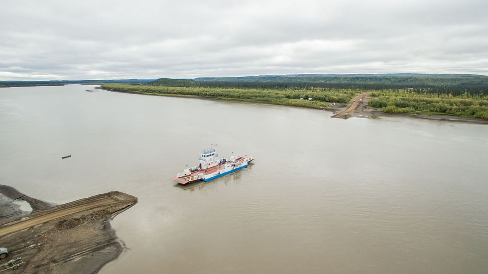
At the confluence of the Mackenzie and Arctic Red River we take a small ferry to Tsiigehtchic. What a wonderful river view! On the Dempster, we soon move on towards Inuvik. In the evening, we stop at Gwich'in Territorial Park, an ideal place for a stop to picnic, paddle or fish at beautiful Campbell Lake. The park is also home to one of the six campgrounds found along the Dempster in the Northwest Territories. We decide to stay overnight and enjoy the evening at the campfire. A bit cheesy – but totally beautiful!

After a total of 736 kilometers through some of the most beautiful and remote wilderness landscapes in North America, we arrive at our destination the next day: Inuvik. About 100 kilometers off the Beaufort Sea, the small town of 3,500 inhabitants is located on a flat, forested plateau near the northern timberline at the transition from taiga to tundra, making it Canada's largest city north of the Arctic Circle. Our timing is perfect, as we arrived just in time for the Great Northern Arts Festival! Every year in July for 10 days, the tranquil little town is transformed into an Indigenous art center, when about 80 creatives and 40 performing artists from Canada's North meet and put their skills on display. A colorful hustle and bustle with fascinating people! Inuvik has two campgrounds and several visitor programs, including various well-organized tours of the town and the famous Igloo Church.

From here, we can book guided day trips into the Western Arctic or continue our road trip on the Inuvik-Taktoyaktuk Highway, leading right to the Arctic Ocean. But that’s another story!
Further information on the Dempster Highway & the Northwest Territories can be found at www.spectacularnwt.com.


Comments